

 By admin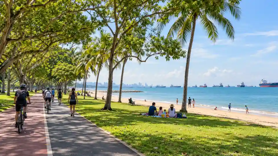
East Coast Park is a long coastal park in Singapore, so reaching “the park” is only half the journey. The better question is which part you want: a family playground, a stretch of beach, a cycling route, a picnic lawn or a particular restaurant. Your best MRT station and bus stop can change with that choice.
The Thomson–East Coast Line offers stations along the Marine Parade corridor, while the East–West Line and local buses provide other approaches. None of these choices means every attraction is beside a train exit. Plan the final walk, use a designated crossing or underpass, and check current service information before a time-sensitive trip.
How to get to East Coast Park: the quick answer
Choose a destination inside the park first. For the central Marine Parade side, compare Marine Parade and Marine Terrace stations on the Thomson–East Coast Line and follow a mapped walking route to the relevant underpass. For other sections, a bus from an MRT station may reduce the final walk. NParks’ older Eastern Coastal Loop guide describes a Bedok MRT and bus 197 approach; its Parkland Green directions also describe bus 31 or 196 from Bedok. Verify the current route and stop before boarding because bus services and access arrangements can change.
| Starting plan | Useful when | What to check |
|---|---|---|
| Thomson–East Coast Line to a Marine Parade corridor station | Your target is on the central coastal stretch | Which underpass reaches your chosen park area |
| East–West Line to Bedok, then bus | A suitable bus stop is closer to your exact destination | Current bus number, direction and stop |
| Bus along Marine Parade or East Coast Road | You are already in the east or prefer fewer train transfers | Final crossing or underpass and walking distance |
| Walk or cycle using a park connector | You want the journey to be part of the outing | Route length, weather and temporary closures |
There is no single “East Coast Park MRT exit” for the whole park. It stretches across several areas. A route that is excellent for Parkland Green may be poor for Coastal PlayGrove or a spot farther east. Enter the exact attraction or park area in your journey planner, not only the park name.
Why the destination inside the park matters
East Coast Park follows Singapore’s southeastern shoreline. NParks’ park information places it along East Coast Parkway and East Coast Park Service Road and maps facilities across different areas. A person heading to a playground may need a different crossing from someone meeting friends for a beach picnic. Two people can both be “at East Coast Park” and still be a substantial walk apart.
Identify a concrete meeting point such as a named amenity, a park area or a carpark. NParks’ map shows features including Coastal PlayGrove, Parkland Green and Bedok Jetty. Names help you choose transit and tell your group where to meet. If a business is the destination, check its current address because park tenants can change.
Looking at the map also reveals a practical issue: the East Coast Parkway and other roads separate residential streets from parts of the coast. Do not choose a bus stop by straight-line distance alone. Find the official pedestrian crossing or underpass that actually leads into the section you want.
Getting to East Coast Park by MRT
The train portion is usually easy; the final walk needs attention. The Thomson–East Coast Line serves the eastern neighbourhoods parallel to the coast, with stations including Tanjong Katong, Marine Parade, Marine Terrace, Siglap and Bayshore. The most useful station depends on your destination. Check the latest rail map and a walking route rather than assuming the station with “Marine” in its name is always best.
Marine Parade MRT for the central area
Marine Parade is a useful starting point when your destination sits around the central Marine Parade side of East Coast Park. Once you leave the station, follow the route to the appropriate crossing or underpass. The coast may be visible on a map while the actual pedestrian route bends around roads and buildings. Allow for that final segment.
If you are meeting at Parkland Green or another named venue, search for that name separately. Do not use “East Coast Park” alone and trust the first route result. The park has more than one access point, and an app may select a point far from your friends.
Marine Terrace MRT for another central approach
Marine Terrace can be more convenient for some destinations east of the Marine Parade approach. The station is within a residential district, so keep to public walkways and check the legal crossing point toward the park. If the route looks longer than expected, compare a bus connection rather than forcing a walk in hot or wet weather.
Use the station exit information shown on the day for the correct street side. A specific lift or accessible exit may matter more than the shortest line on a map. People with strollers or luggage should plan the entire route, including the road crossing into the park.
Siglap and Bayshore for eastern sections
For a destination toward the eastern part of the park, compare Siglap and Bayshore with a bus approach. The best station is not determined by the broad park name. It depends on which area, shelter, jetty, playground or carpark you need. An eastern park entrance can be a poor choice for a central picnic.
Some visitors use the park as part of a longer walk or cycle through a park connector. In that case, a station that puts you near the connector may be more useful than one closest to the beach. Decide whether you want the shortest arrival or an enjoyable route to get there.
Bedok MRT and an onward bus
Bedok is on the East–West Line. NParks’ park listing identifies Bedok as a nearby station in the broader sense, and its Eastern Coastal Loop material describes a bus connection toward the park. Do not interpret “nearby” as meaning the beach is just outside the station. A bus, longer walk or cycle may still be needed.
NParks has published directions for Parkland Green that mention buses 31 and 196 from Bedok, while an Eastern Coastal Loop guide refers to bus 197 for an East Coast Park approach. These guides relate to particular routes and were produced at different times. Confirm the current stop, service direction and last walk with LTA’s journey planner before travelling.
How to choose the best MRT station
- Find your exact destination on the current NParks park map.
- Identify the nearest practical pedestrian access point, crossing or underpass.
- Compare the walking route from Marine Parade, Marine Terrace, Siglap, Bayshore or a bus stop.
- Check the train transfer count from your starting station.
- Choose the route with a comfortable final walk, not merely the fewest rail stops.
A walking route that takes a few extra minutes on paper can feel much easier if it has shade or a clear underpass. Conversely, a short straight-line distance can hide a difficult road crossing. If your visit involves children, older relatives or a person with limited mobility, comfort should take priority over a tiny difference in estimated travel time.
When two routes are similar, choose the one with a clearer meeting point. It is easier to tell friends “meet at the entrance near Coastal PlayGrove” than “meet somewhere at East Coast Park.” Share a map pin and the official amenity name when arranging a group outing.
How to get to East Coast Park by bus
Buses are useful because the park runs along a broad coastal corridor rather than around one station. A service along Marine Parade Road or East Coast Road may bring you closer to your preferred access route. The bus still may not enter the exact park area, so check the stop and walking directions separately.
From Bedok MRT
If you arrive on the East–West Line, compare bus services from Bedok toward the part of the coast you want. NParks’ published Parkland Green directions name buses 31 and 196, while another NParks route guide uses 197 for an East Coast Park access route. These are starting points for planning, not a guarantee that every service is best for every park destination.
At the interchange or stop, check the bus destination and the direction of travel. The same service number on the opposite side of a road may take you away from the park. Follow the live stop list and alight where the route planner indicates for your precise attraction.
From other eastern neighbourhoods
If you already live or stay in the east, a direct bus may be simpler than travelling to a train station and backtracking. Enter your actual origin and a named location within the park. Compare the total journey, including the walk after alighting. A route with one less transfer can be more pleasant even if its scheduled duration is similar.
Bus frequencies and road conditions vary. Do not build a tight timetable around a single predicted arrival. If you are heading to an event or reservation, leave a buffer for the bus wait and the final pedestrian crossing.
How to avoid the wrong stop
Look for the park access route before getting off. A bus stop that appears directly opposite the shoreline may be separated by a road or fencing. Confirm the nearest designated underpass or crossing in a current map. Do not cut across the expressway or cross where pedestrians are not permitted.
Keep your phone battery available for the final approach. If you are unsure, remain at a sheltered public stop while checking the route rather than walking along a vehicle access road. Ask your group to share a more exact pin if “the beach” is all you have been given.
Route planning for popular parts of East Coast Park
Parkland Green
Parkland Green is one of the named activity and dining areas. NParks has published a dedicated “Getting to Parkland Green” document with a Bedok MRT and bus approach. The area is also shown on the park map. Search for “Parkland Green” in your current journey planner rather than selecting the entire park.
Check whether part of the lawn or a nearby facility is under maintenance before planning a picnic. NParks publishes advisories on its park page; these can change the best spot to sit or the route through an area. A venue being open does not mean every lawn next to it is available.
Coastal PlayGrove
NParks places Coastal PlayGrove in East Coast Park Area B, with the address 902 East Coast Park Service Road. Families should route to Coastal PlayGrove itself. Entering “East Coast Park” can leave you at a more distant section and turn a playground trip into a long walk.
Check the current status of individual play features before leaving. NParks notes maintenance closures on its park information when parts of an amenity are unavailable. Pack water, sun protection and a change of clothes if your children are likely to play actively.
Marine Cove and other family areas
Marine Cove is another named family-oriented part of the park. It is useful to confirm the exact venue or amenity near which your group will gather. Families with young children may prefer a route with an easier crossing and nearby facilities, even if a different station has a slightly shorter theoretical walk.
Do not assume that one playground, toilet or food outlet represents the whole park. Facilities are spread out. Locate your first stop and a backup place to rest before you start, especially on a hot afternoon.
Bedok Jetty and eastern coastal stops
Bedok Jetty appears on NParks’ park map and offers a different type of outing from the central play and dining areas. The best public transport approach can differ from the one used for Parkland Green. Route specifically to the jetty or the nearest mapped access point. Allow extra walking time if you plan to continue along the coast.
Stay within permitted areas and respect any posted notices. If you are heading there at sunrise or after dark, check your return transport in advance and take ordinary precautions on less crowded paths.
Arriving on foot or by bicycle
East Coast Park is connected to Singapore’s Park Connector Network. NParks describes it as part of the Eastern Coastal Loop and the Round Island Route. The Bedok, Siglap and Coastal park connectors link the area with other neighbourhoods. A cycling trip can therefore start well before you reach the beach.
Choose a route that matches your ability and the weather. Look at current connector advisories, since maintenance or improvement works can affect a section. Follow path markings, give way where appropriate and slow down near children, pedestrians and busy junctions.
If you plan to rent a bicycle, check current rental locations and return rules rather than assuming you can drop it at any point. A long coastal ride can carry you far from your chosen MRT station. Decide where the ride will end and how you will return before setting off.
What to do after you arrive
Walk beside the sea
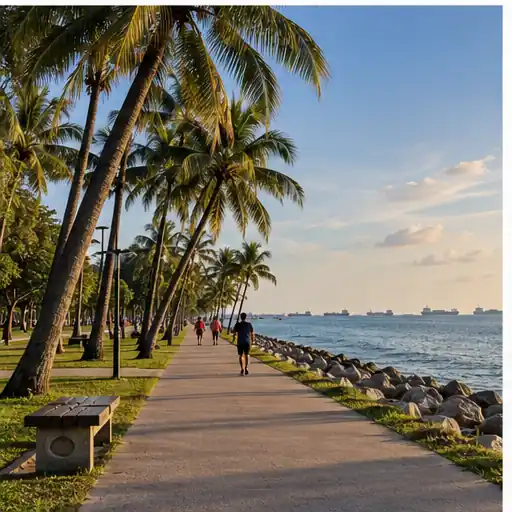
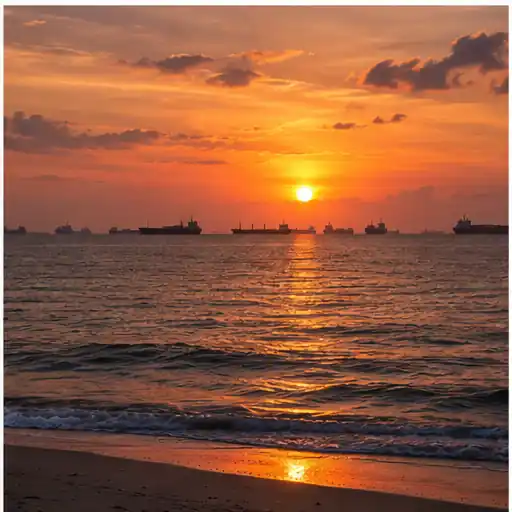
A simple seaside walk is enough to make the trip worthwhile. Choose a comfortable section rather than trying to cover the entire shoreline. Look for shade, a rest point and a return route. The coastal view includes ships offshore and changing light through the day.
Morning and later afternoon can feel more comfortable than the strongest midday sun. Carry water and turn back before the return walk becomes tiring. If a sudden storm develops, move away from exposed shore areas and seek appropriate shelter.
Cycle or skate on suitable paths
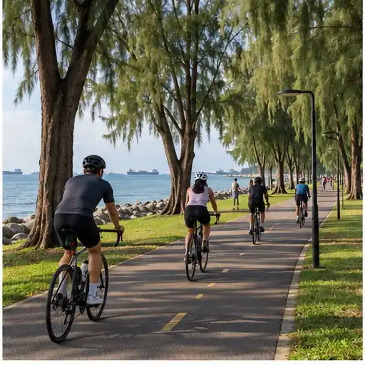
East Coast Park is widely used for recreational riding. Keep to the paths and rules that apply to your activity. Mixed-use areas need patience: a person walking, a child learning to ride and an experienced cyclist may all be moving at different speeds.
Agree on a turnaround point before the group spreads out. When stopping for a photograph, move off the travel path. If an area is unusually crowded, slow down or dismount where necessary for safety.
Have a picnic
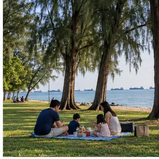
Find a lawful and available lawn or seating area, keeping clear of paths and planted areas. Check NParks’ current notices for maintenance work before choosing a particular lawn. Pack food securely, carry your rubbish to a bin and avoid leaving anything behind that could harm wildlife.
A picnic plan should include a rain option. A blanket and food are pleasant in dry weather, but a sudden shower can change the day quickly. If your chosen area is closed, use the map to find another suitable space rather than entering a cordoned section.
Visit a family play area
Coastal PlayGrove, Marine Cove and other nodes provide different family experiences. Check the age suitability and current facility status for the one you want. Supervise children near cycling paths, water and busy walkways. A playground is a destination in its own right, so its exact location should guide your transport choice.
Accessibility and comfort
NParks describes East Coast Park as wheelchair accessible, with exceptions in some parts of Xtreme Skatepark in Area F. That does not mean every route from every transit stop is identical. Check lifts, crossings, underpasses and the distance from your station or bus stop to the destination.
For a wheelchair user, stroller or someone who tires easily, compare a bus stop closer to the chosen amenity with a rail route that has a long last walk. Ask a venue for access details if you have a specific appointment. A good park visit begins with a route that your entire group can use comfortably.
Shade, water and rest stops matter too. The sea breeze can make the coast feel pleasant while the sun remains strong. Plan a shorter loop with an option to extend it, rather than committing to a long one-way walk with no convenient return point.
Food, facilities and practical preparation
Food and drink options are spread through different sections rather than concentrated at one entrance. A person heading for a named outlet should verify its current location and operating hours. If you are carrying a picnic, check the rules for the activity you plan, including whether booking is required for a facility such as a barbecue pit.
Use NParks’ current map for toilets, play areas, carparks and other amenities. A facility symbol on an old screenshot may not reflect temporary maintenance. The official park page is a better place to check advisories shortly before a visit.
Pack according to the outing: water for a walk, sun protection for an open lawn, rain protection during unsettled weather and suitable shoes for a longer route. If you plan to cycle, include a safe way to carry your belongings. Keep valuables with you rather than leaving them on a picnic mat while you explore.
Common mistakes when travelling to East Coast Park
Using only the park name: A route planner may pick an access point unrelated to your actual destination. Search for a named amenity or park area.
Assuming the station is on the beach: A Thomson–East Coast Line station can be a useful approach, but the final walk and crossing remain part of the journey.
Following an old bus guide without checking: NParks material can identify useful route ideas, while current service and stop information should be verified with a live transport planner.
Crossing a road at the nearest-looking point: The shortest visible line across a map may not be a legal pedestrian route. Use the designated crossing or underpass.
Meeting without a precise point: Share a named amenity and a map pin. The park is too long for “meet at East Coast Park” to be reliable.
Ignoring temporary closures: A lawn, play feature or connector section may be under maintenance even when the rest of the park is open.
Sample plans for different visitors
A short coastal break
Choose a central access point that fits your starting location. Take the train or bus, follow the proper pedestrian route into the park, walk by the sea and return the same way. Keep the outing simple and avoid spending most of your time travelling between distant amenities.
A family playground trip
Set Coastal PlayGrove or another specific play area as the destination. Check its status, choose the route with the easiest final walk and plan a food or rest break. Tell everyone in the group which park area you will use. This is more reliable than choosing a station before choosing the playground.
A cycling afternoon
Choose a start and finish point, then decide whether to bring or rent a bicycle. A park connector may provide an enjoyable approach from another neighbourhood. Check any works notices and leave daylight or a well-understood return route in your plan.
A picnic with friends
Share a precise meeting pin, agree on the nearest transit approach and check that the lawn is available. Some friends may find the Thomson–East Coast Line easiest; others may use a bus. They can arrive by different modes if the final meeting point is unambiguous.
Frequently asked questions about East Coast Park
Which MRT station is closest to East Coast Park?
There is no single answer for the whole park. Compare stations such as Marine Parade, Marine Terrace, Siglap and Bayshore against your exact destination and access route.
Can I reach East Coast Park directly by MRT?
You can use a nearby Thomson–East Coast Line station, but you must still walk to the park through an appropriate crossing or underpass.
Can I go from Bedok MRT by bus?
Yes, NParks has published Bedok MRT and bus approaches for parts of the park. Check current services, direction and the stop for your destination.
Is Parkland Green the same place as Coastal PlayGrove?
No. They are separate named areas within East Coast Park. Enter the specific one you want in your journey planner.
Is East Coast Park wheelchair accessible?
NParks describes the park as wheelchair accessible except for some parts of Xtreme Skatepark. Check your particular transit-to-park route as well.
Is East Coast Park good for cycling?
Yes. It connects with the Park Connector Network. Follow the applicable path rules and check for temporary closures before a longer ride.
Where should a group meet?
Choose a named amenity, park area or clear entrance and share a map pin. The park name alone is too broad.
How do I check for park closures?
Read the latest advisories on NParks’ East Coast Park page, especially if you are visiting a particular lawn or play feature.
Are bus numbers always the same as in older guides?
Not necessarily. Use an up-to-date LTA journey planner to verify the route, stop and direction before leaving.
Plan your East Coast Park trip
The easiest way to reach East Coast Park is to choose the exact place you want first, then compare the full MRT, bus and walking routes. The Thomson–East Coast Line is useful for several central and eastern approaches, while a bus from Bedok or another neighbourhood may better serve a particular entrance. Check current transport information and NParks advisories, use the designated pedestrian access, and leave time to enjoy the coast once you arrive.
Sources
- NParks: East Coast Park visitor information
- NParks: East Coast Park park connector guide (PDF)
- NParks: Coastal PlayGrove
- NParks: Eastern Corridor routes
- LTA: Singapore rail network map