

 By admin
Singapore’s MRT network connects residential areas, shopping districts, business hubs and popular attractions across the island. MRT Station Maps make it easier to check train lines, find station locations and identify where to change trains. The Land Transport Authority (LTA) provides an official rail network map, along with downloadable map files and an online interactive map. You can also use station codes to identify individual stops, check connections between lines and get a clearer idea of your route before leaving home. Here’s how to read and use Singapore MRT station maps.
2. TL;DR – Singapore MRT Station Maps at a Glance
- Find the official Singapore MRT/LRT map on the LTA website.
- Check six MRT lines, their colours and station names.
- Use station codes to identify individual stops.
- Look for interchange stations when changing trains.
- Save the official PDF for offline reference.
- Use an interactive map to search for particular stations.
3. Singapore MRT Station Map (Official Network Map)
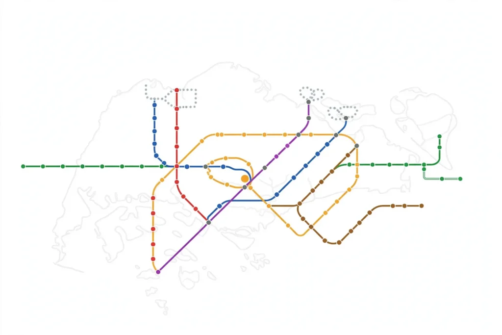
The official Singapore MRT network map shows the island’s rail connections, including station names, MRT lines, LRT services and interchange points. Each train line has its own colour and abbreviation, so passengers can follow a route across the map without having to read every station name.
The LTA rail network page provides the system map in downloadable PDF format. It also gives passengers access to an online interactive MRT/LRT map, where they can select a line or search for a station. Maps are also available at stations for passengers who prefer a printed reference. Rail Network+1
There are different map styles, and each serves a slightly different purpose. A geographic map gives a better idea of where stations sit around Singapore, while a schematic map focuses on train connections rather than exact distances.
| Map format | Information provided | Best use |
|---|---|---|
| Interactive MRT map | Searchable rail network and station information | Finding a particular station |
| PDF network map | MRT and LRT lines with station names | Offline viewing and printing |
| Geographic map | Approximate real-world station locations | Understanding areas and distances |
| Schematic map | Simplified lines and train connections | Planning a train journey |
For the official version, look for the LTA rail network and MRT/LRT map resources. Check the map date before using an older saved copy, especially when travelling to recently opened stations.
4. Singapore MRT Lines and Station Locations
Singapore has six main MRT lines. Each has a different colour and short code on the network map. Once you recognise these, it becomes easier to trace a route from one part of the island to another.
| MRT line | Code | Map colour |
|---|---|---|
| North-South Line | NSL | Red |
| East-West Line | EWL | Green |
| North East Line | NEL | Purple |
| Circle Line | CCL | Orange |
| Downtown Line | DTL | Blue |
| Thomson-East Coast Line | TEL | Brown |
The North-South Line connects areas including Jurong East, Orchard and Woodlands. The East-West Line runs across the western and eastern parts of Singapore, while the North East Line serves stations such as Chinatown and HarbourFront. The Circle Line links several city-fringe areas, and the Downtown Line serves locations including Bugis. The Thomson-East Coast Line connects northern, central and eastern parts of the island.
You will also see LRT services on Singapore train maps. These include Bukit Panjang LRT, Sengkang LRT and Punggol LRT. They serve local neighbourhoods and connect residents to nearby MRT stations.
When reading a map, check whether a line is marked as operating or planned. Future rail projects and extensions may appear on some network maps, but a planned station is not necessarily open for passenger service. LTA’s rail network page lists the current rail lines and provides its official system map. Rail Network+1
5. How to Find a Specific MRT Station on the Map
Finding a station is usually easier when you know either its name or station code. Start by opening the Singapore MRT map and looking for the station name. On an interactive map, use the search field or select the relevant MRT line to narrow down the results.
You can also identify a station through its code. For example, Chinatown is marked NE4 on the North East Line and DT19 on the Downtown Line. The two codes show that the station serves both lines.
After finding the station, check its line colour and nearby interchange points. If you are using a geographic map, zoom in to see the station’s approximate position. For street-level directions, use a regular map service as well, since a rail network diagram may not show every road, building or station entrance.
6. MRT Station Codes and Map Symbols Explained
Station codes help passengers identify stops quickly. The letters refer to the MRT line, while the number identifies a station along that line. For example, NS refers to the North-South Line, EW to the East-West Line and TE to the Thomson-East Coast Line.
| Station | MRT station codes |
|---|---|
| Jurong East | NS1 / EW24 |
| Dhoby Ghaut | NS24 / NE6 / CC1 |
| Chinatown | NE4 / DT19 |
| Bugis | EW12 / DT14 |
| HarbourFront | NE1 / CC29 |
Other codes include CC for the Circle Line and DT for the Downtown Line. On a network map, the line colour usually appears alongside the station code. This makes it easier to follow a route and check which service you need.
A station with more than one code is generally connected to multiple MRT lines. Dhoby Ghaut, for example, has three codes because it connects the North-South, North East and Circle lines. Check the map legend to understand interchange symbols and other markings. Some maps also show LRT connections, bus interchanges and stations that are not yet open.
7. MRT Interchange Stations and Connections
An interchange station connects two or more MRT lines, allowing passengers to change trains during a journey. These stations are useful when your starting point and destination are on different lines.
| Interchange station | Connected lines |
|---|---|
| Dhoby Ghaut | NSL, NEL, CCL |
| Bugis | EWL, DTL |
| Chinatown | NEL, DTL |
| HarbourFront | NEL, CCL |
| Bishan | NSL, CCL |
When checking an MRT interchange map, look for a station name that appears on more than one coloured line. The station codes can confirm the connection. Once inside the station, follow the signs for your next line and check the platform direction before boarding.
Some transfers involve walking through connecting passages, and the distance can vary between stations. Allow a little extra time if you are unfamiliar with the interchange or travelling with luggage, children or someone who needs step-free access.
8. How to Download and Use Singapore MRT Maps
You can save a Singapore MRT map PDF from the LTA rail network page. Open the page, find the system maps for download section and select the English PDF or another available language. Save the file to your phone, tablet or computer.
A downloaded PDF is useful when you want to check station names without relying on an internet connection. You can zoom in to read smaller labels and print a copy if needed. The interactive MRT map is more useful when you want to search for a station or select a particular line.
Before a journey, check that your saved map is the latest version. A PDF stored on your phone will not update automatically when a new station opens or a line changes.
9. Tips for Using MRT Station Maps
- Find your destination station before starting your journey.
- Check the MRT line colour and station code.
- Identify an interchange if you need to change trains.
- Follow station signs for the correct platform and exit.
- Use the latest official map rather than an old saved copy.
- Check lift and step-free access information if you need an accessible route.
A network map is useful for train connections, but station signs and local maps can provide more detail once you arrive.
10. Frequently Asked Questions
Where can I find the official Singapore MRT station map?
You can find the official Singapore MRT station map on the Land Transport Authority website. Its rail network section provides a system map for download and access to an interactive MRT/LRT map. Rail Network+1
How many MRT lines are there in Singapore?
Singapore has six main MRT lines: North-South, East-West, North East, Circle, Downtown and Thomson-East Coast. LRT services operate separately in areas such as Bukit Panjang, Sengkang and Punggol.
Can I download the Singapore MRT map as a PDF?
Yes. The LTA rail network page provides downloadable system maps in PDF format. Save the file on your phone or computer so you can refer to it offline.
How do I find an MRT station using its station code?
Look for the letters and number printed beside the station name. For example, NE4 identifies Chinatown on the North East Line, while DT19 identifies the same station on the Downtown Line.
Which Singapore MRT stations are interchange stations?
Examples include Dhoby Ghaut, Bugis, Chinatown, HarbourFront and Bishan. These stations connect different MRT lines, so passengers can transfer between services.
11. Conclusion
MRT Station Maps make it easier to check Singapore’s train lines, station codes and interchange connections before travelling. Use the latest LTA network map as your main reference, and check station signs for directions once you arrive. A saved PDF is handy when you need an offline copy